

Global study of glacier debris shows impact on melt rate
May 19, 2021
Rod Boyce
907-474-7185
The work is the first global assessment of Earth’s 92,033 debris-covered glaciers and shows that debris, taken as a whole, substantially reduces glacier mass loss.
The results will affect sea level rise calculations and allow for improved assessment of hazards faced by nearby communities.
“This is the first step to enable us to start projecting how these debris-covered glaciers are going to evolve in the future and how they're going to affect glacial runoff and sea level rise,” said glaciologist David Rounce, the lead author of a paper published April 28 in Geophysical Research Letters, a publication of the American Geophysical Union.
Rounce conducted the research while at the Geophysical Institute but now works at Carnegie Mellon University.
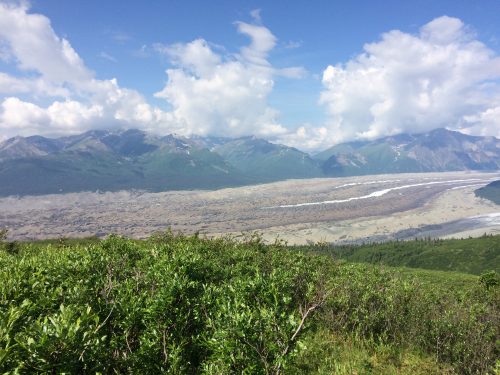
The effects of debris on regional and global projections of glacial melt have been unknown due to the lack of accurate debris thickness estimates, according to the study. Boulders, rocks and sand cover about 5% of Earth’s ice caps and mountain glaciers. Alaska is one of the regions with the most debris cover.
“Debris-covered glaciers are going to become more prominent, and, yet, there wasn’t a single global glacier model to account for debris-covered glaciers because we didn't know what the debris thickness was,” Rounce said.
Rounce and Geophysical Institute glaciology professor Regine Hock, a co-author of the study, have been working on the problem since 2017 through their participation in NASA’s High Mountain Asia Team and the agency’s Sea Level Change Team.
The researchers used a combination of elevation change data and surface temperature from satellite imagery to arrive at the thickness levels for the entire surface of each of the world's debris-covered glaciers.
The research findings will allow for improved risk assessment for communities located near debris-covered glaciers. Rapid melting can lead to formation of glacial lakes, creating potential flood hazards.
The research findings will also affect estimates of how sea level will change in a warming climate.
“We don't know what the impact is going to be on sea level rise estimates, but we know that it's likely going to change those estimates,” Rounce said.
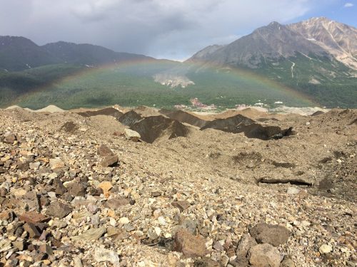
Alaska’s Kennicott Glacier in Wrangell-St. Elias National Park and Preserve played a key role in the study as a source of validation for the research.
“Kennicott is singled out because it's one of the few debris-covered glaciers in Alaska that has debris thickness measurements and surface melt measurements beneath debris,” he said. “There are very few debris-covered glaciers that have measurements that are publicly available.”
ADDITIONAL CONTACTS: David Rounce, 412-268-2083, drounce@cmu.edu ; Regine Hock, rehock@alaska.edu